Sustainable Walney Extension Offshore Wind Farm

cores-image

DONG Energy

Walney Extension OWF

Archaeological Monitoring Assessment and geoservices

The Walney Extension Offshore Wind Farm Project is a proposed development of up to 207 wind turbines located in the Irish Sea, off the Cumbria coast. When complete it will have a capacity of 750MW and be capable of powering over half a million homes.

Maritime Archaeology Ltd has undertaken several archaeological investigations as part of this project on behalf of the developing company DONG energy.

Firstly a comprehensive desk based assessment was carried out, incorporating English Heritage’s HSC (Historic Seascape Characterisation) methodology. This brought together information from sources relating to sea level change, coastal activity, and known shipwrecks and other wreckage in the area. It used data from the UK Hydrographic Office along with various other historical, geographical and archaeological sources. This assessment makes it possible to identify areas of high archaeological potential and can also inform the other aspects of the study, such as identification of anomalies located by geophysical surveys.

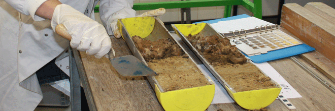
As part of our clients’ need for geophysical surveying, we provided a training day for vibrocore sample collection for borehole contractors. These theoretical and practical sessions allowed contractors to operate without the need for an archaeologist to be present on board the vessel during sample collection, and thus avoided unnecessary expense in the long run.

The outputs of our archaeological and geoservices have meant the recommendation of a number of archaeological exclusion zones following the identification of high and medium potential anomalies. These recommendations will allow work to continue in a way that minimises impact on archaeological features that are beneficial to the current understanding of human activity in the area, from the Late-Pleistocene and into the Mid-Holocene.

Discover Oceanography and Archaeology

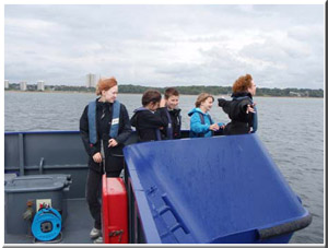
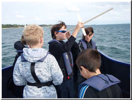
In July 2009 there were two trips on the National Oceanography Centre’s research vessel RV Callista. The trips were organised by HWTMA with the help of the Discover oceanography crew The trips were aimed at 10-13 year olds with a focus on science and how it is essential in many careers and disciplines such as maritime archaeology and oceanography. callista1jpg

The youngsters were onboard for four hours, during which time they learnt about different scientific techniques used in maritime archaeology and early methods of navigation. They had a go at using replica navigation instruments similar to those that would have been used hundreds of years ago.In addition the young people had a chance to see a range of marine sampling techniques used in studying life beneath the waves. Seabed samples were taken so they could see what was living in the mud and a trawl of the seabed revealed a miriad of living creatures.

This is what some of the participants said after the trip:

“I found out about different methods of navigation”

“I liked the whole day”

“Everything was best today!”

“I learned about sea algae”

“The best thing today was trying to catch the fish”

“I did not like that I had to leave after such a short time”

“The best thing today was to see animal I haven’t seen before”

“The best thing today was to learn about the boats gear”

“We learned how to make a compass with needle and water”

“I did not like to put my hands in the mud”

callista2

Young Archaeologists Dive In!

Eight lucky and brave 12 to 17 year olds spent May 2008 exploring their sunken history as they dived into the cold Solent sea to explore ancient shipwrecks with maritime archaeologists from the Hampshire and Wight Trust for Maritime Archaeology (HWTMA).

As well as diving on shipwrecks including the Pomone, War Knight and Joannis Millis, the young pioneers also investigated the foreshore for WWII archaeology, and tried their hand at rowing a reproduction of an ancient coracle. With their new-found skills the group measured, drew, photographed and recorded the archaeology in exactly the same way as professional maritime archaeologists.

No other project of this kind has ever taken place before with such young archaeologists. HWTMA Education Officer, Alison Hamer says that she is “extremely proud of the children’s determination and is impressed with how the challenge brought out their best qualities”.

To find out more visit the website designed by the young people at, www.divein2008.co.uk

Speed networking

Speed networking is a fairly new concept based on the idea of speed- dating where you get to meet as many people as possible, in a short amount of time. Speed-networking has proven to be successful in the business sector and is now a popular component of many business conferences. A dynamic networking event where you are guaranteed the opportunity to discuss ideas and exchange contact details with many others.

Speed Networking event summary (Friday the 13th November 2009)

speed1

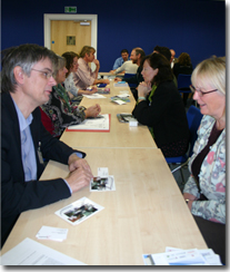
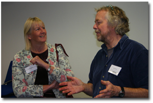
Despite the inauspicious date the event, devised and delivered by HWTMA was a great success! The event, funded by English Heritage through the Aggregates Levy Sustainability Fund, took place at the National Oceanography Centre in Southampton and was attended by educators and professionals from a wide variety of organisations. Some were relatively local while others travelled quite a distance to take part.

After a brief introduction and a very interesting talk by the guest speaker Julian Richards everyone sat down do take part in an intense and productive speed networking session. With 30 participants, all needing to meet each other individually, 4 minute sessions were arranged. Participants had been advised to bring at least 30 business cards and promotional material which they exchanged during their sessions.

The time rushed by and after a short lunch break, everyone was back networking again. Two sessions, almost three hours, and 30 people later all the tried but happy participants were served a glass of wine while being showed around HWTMA’s brand new community outreach van.

Another Speed Networking event is planned for September 2010 and if this event is anything to go by, places are likely to book up early, so please contact Christin Heamagi if you would like to be contacted when the new dates have been arranged.

I look forward to the next speed networking event,

This was a really good idea! It was a good event- Well done!

It is easy to work “tunnel visioned” in your own organisation- it is great to be able to expand one’s horizons and meet fellow professionals from elsewhere

Very well organised, much appreciated event

Excellent but exhausting!

speed2

Enhancing the National Monuments Record

The overall aim of this project is to examine the perceived inconsistencies between the National Monuments Record (NMR) and United Kingdom Hydrographic Office (UKHO) datasets and, where applicable, suggest solutions as to how these discrepancies should be overcome. Continuous communication with the NMR and UKHO and SeaZone will ensure detailed understanding of both datasets.

This project analyses the maritime NMR and UKHO data in areas that are currently subject to marine aggregate dredging as well as areas of potential marine dredging. This will support the work undertaken by the NMR in relation to finds reported through the EH-British Marine Aggregate Producers Association (BMAPA) Protocol for Reporting Finds of Archaeological Interest. It will enable better informed licencing processes and facilitate a greater understanding of the data required to support UK Government priorities such as marine spatial planning.

This project involves four phases of work:

Phase 1: identify the scale of the problem and make recommendations.

Phase 2: test the recommendations to identify fit for purpose and practical solutions.

Phase 3: resolve data issues (where applicable) based on Phase 2 results.

Phase 4: production of guidance notes.

The current Phase 1, the identification of the scale of the problem, consists of:

  • Undertaking a pilot study by reviewing NMR and UKHO datasets in and around all existing aggregates extraction areas;
  • Undertaking a pilot study by reviewing NMR and UKHO datasets in the Thames Estuary and Humber areas since these are areas of potential aggregate extraction;
  • Reviewing NMR and UKHO datasets in all Protected Wreck Sites in England as a comparative tool;
  • Comparing the results of the three pilots;
  • and Making recommendations for possible solutions.

Due to the nature of UKHO and NMR datasets, this phase will also include cross referencing both datasets to enable consistency and achievement of standards according to standards and protocols for the marine sector (http://www.oceannet.org/). Consequently, this approach will enable the essential delivery of effective evidence to allow management decisions within the marine environment. Any issues regarding UKHO data are outside the framework of this project but, if they arise, they would be fed back to UKHO and SeaZone.