Sustainable Walney Extension Offshore Wind Farm

cores-image

DONG Energy

Walney Extension OWF

Archaeological Monitoring Assessment and geoservices

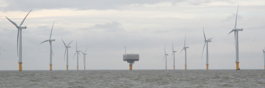
The Walney Extension Offshore Wind Farm Project is a proposed development of up to 207 wind turbines located in the Irish Sea, off the Cumbria coast. When complete it will have a capacity of 750MW and be capable of powering over half a million homes.

Maritime Archaeology Ltd has undertaken several archaeological investigations as part of this project on behalf of the developing company DONG energy.

Firstly a comprehensive desk based assessment was carried out, incorporating English Heritage’s HSC (Historic Seascape Characterisation) methodology. This brought together information from sources relating to sea level change, coastal activity, and known shipwrecks and other wreckage in the area. It used data from the UK Hydrographic Office along with various other historical, geographical and archaeological sources. This assessment makes it possible to identify areas of high archaeological potential and can also inform the other aspects of the study, such as identification of anomalies located by geophysical surveys.

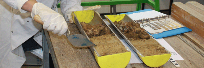
As part of our clients’ need for geophysical surveying, we provided a training day for vibrocore sample collection for borehole contractors. These theoretical and practical sessions allowed contractors to operate without the need for an archaeologist to be present on board the vessel during sample collection, and thus avoided unnecessary expense in the long run.

The outputs of our archaeological and geoservices have meant the recommendation of a number of archaeological exclusion zones following the identification of high and medium potential anomalies. These recommendations will allow work to continue in a way that minimises impact on archaeological features that are beneficial to the current understanding of human activity in the area, from the Late-Pleistocene and into the Mid-Holocene.

Our work: DONG Energy Gunfleet Sands Offshore Wind Farm

Gunfleet sands wind farm

DONG Energy

Gunfleet Sands 3 Wind Farm Demonstration Project

Archaeological & geoarchaelogical services 

Maritime Archaeology Ltd has carried out a number of studies in order to inform planning and construction of the DONG Energy Gunfleet Sands Offshore Wind Farm since 2003. This wind farm is located seven kilometres off the Essex coast with a total installed capacity of 172MW, providing clean renewable electricity to approximately 125,000 households – or more than 20% of the households in Essex in the years to come.

Gunfleet Sands 1 consists of 30 turbines each of 3.6MW and Gunfleet Sands 2 consists of 18 turbines each with a capacity of 3.6MW. In 2012 we were engaged to assist with the Gunfleet Sands 3 Demonstration Project for two next generation high capacity 6MW offshore wind turbines. Through a multi-disciplinary approach, we provided a comprehensive package of archaeological advice and assessments in order to ensure that our client could carry out the development efficiently, and in a way that prevented negative impact on archaeological features.

We were selected after a rigorous tendering process to produce the Archaeological Written Scheme of Investigation (WSI) for the project, and to deliver a strategy to engage heritage curators, academics, contractors and other stakeholders.

Our archaeologists followed this by assessing and interpreting a range of archaeological and geophysical data. This included a variety of techniques, including sub-bottom, side scan and multi-beam sonar which were used alongside magnetometry to create a clear and detailed image of the seabed. During this process we identified a number of previously unknown anomalies and developed mitigation strategies including carefully considered archaeological exclusion zones.

Through geoarchaeological assessment we also advised DONG Energy of both the palaeoenvironmental and geomorphological characteristics of the survey area to identify any significant environmental deposits. Following established best practice, sub-samples were taken from boreholes and vibrocores onshore and offshore for detailed inspection. This allowed our client to put in place mitigation measures during planning and construction, and to learn as much from this important paleaoenvironmental material as possible while simultaneously helping to drive the Project forwards.

Finally, we delivered a programme of onshore and offshore watching briefs during construction with an archaeologist recording and observing both on-shore and on the survey vessel. If archaeological material was identified our experienced field team were ready to be deployed quickly for detailed assessment and to advise on any mitigation action.

Overall, throughout this project we provided a staged and pre-costed approach to this project in advance so as to ensure that the development proceeded without undue costly delay. Furthermore, the results of our geoarchaeological study will be available in the public domain for future study. And it is the value of this data that will offset any low-level impact of the development in the region.