02-06-2015
Solving the mystery-is this the Santa Lucia wrecked in 1567?
Yarmouth Roads is one of only 49 Protected Wrecks around the coast of England. It is designated under the Protection of Wrecks Act 1973
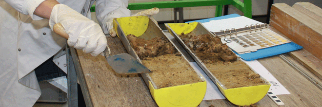
The site is thought to encompass the remains of a late 16th century Spanish merchant carrack, possibly the Santa Lucia, which is recorded as lost in 1567 carrying wool to Flanders. However, there are some queries over whether the pottery assemblage supports this identification. A close investigation of the ship’s timbers, the first time such an initiative has taken place on this site, may provide the information necessary to reach a conclusion on date, provenance, and identification.
Maritime Archaeology Ltd, is now working together with the ForSEAdiscovery: Forest Resources for Iberian Empires: Ecology and Globalization in the Age of Discovery project, a Marie Curie Initial Training Network funded through the European Union Framework 7 program to investigate the timbers in detail.
One of the project’s aims is to reconstruct past Iberian forests and how shipbuilding from the 16th-18th centuries maybe have impacted them. Therefore, a series of known Iberian ships or shipwrecks with surviving hull timbers is necessary to provide information on the raw wood material used in ship construction.
The shipwreck at Yarmouth presents an ideal case study as a supposed Spanish ship dating to the 16th century. The ForSEAdiscovery partnership provides the opportunity to approach the site with updated research questions and support with which to answer them.
A focused on-site investigation starting now in June 2015 of this shipwreck will significantly increase understanding of the ship itself and its wider socio-economic, political, environmental, and even philosophical contexts during a period of rapid and widespread change. This vessel’s selection for inclusion within this multi-partner international project serves to underscore the global research value of its remains.
More information
Yarmouth roads wreck http://www.maritimearchaeologytrust.org/yarmouth
Forseadiscovery – http://forseadiscovery.eu/
Protected wreck sites http://historicengland.org.uk/listing/what-is-designation/protected-wreck-sites/
Maritime archaeology Research services.
Investigation of marine cultural heritage is a developing field. Maritime Archaeology Ltd draws on over 22 years of experience gained in, research and development of approaches and techniques for the investigation, monitoring and management of archaeology under water and in the inter tidal zone.
- Shipwreck inspection, survey, sampling, excavation and monitoring.
- From single finds to excavation archives we can undertake or arrange artefact, sample and deposit assessment, analysis and dating.
- Shore line and coastal management studies.
- Utilising heritage data and information to feed into broader marine environmental studies, often involving inter-agency and partnership working and the management of large digital data sets.
- Services for the heritage sector for the development of digital data standards and content and the analysis of information for aspects of marine spatial planning and management.
28-05-2015
Mesolithic site being washed away in the tide
Maritime Archaeology Ltd is currently working on a Mesolithic underwater site in the Solent
The site of Bouldnor Cliff lies 11 m underwater off the north coast of the Isle of Wight. It sits within a submerged forest that has come to light after being pressure wrapped in silt and preserved for 8,000 years. Today, strong currents are taking the silt away to reveal the lost secrets of people that lived when Europe was segregated by the North Sea.
Archaeological discoveries have been made by ongoing observation and sampling of the eroding landscape. The finds are remarkable. Many of the recovered items are new to archaeology, giving us unique insights into the lives of our ancestors. They include the oldest string in the UK, advanced wood working technologies and the discovery of wheat 2,000 years before it officially arrived in Britain.
The erosion creates great opportunities to discover more but it also destroys everything: unless it is rescued. This week the maritime archaeologists are focusing on recording and sampling the site to increase their understanding of the submerged site and how to best protect it, before its too late.
More information:
SPLASHCOS – Submerged Prehistoric Archaeology and Landscapes of the Continental Shelf
Maritime Archaeology Diving services
Our Health and Safety Executive (HSE) compliant diving team can provide a range of archaeological diving services to meet your needs, including;
- Anomaly inspection
- Excavation
- Underwater photography
- Media footage


